- Info MM:K
Contact
Muzejska pot 3, 1241 Kamnik, Slovenia
+386 (0)1 8317 662
info@muzejkamnik.siDŠ: 92474519
MŠ: 5095417000
TRR: SI56 0110 0600 0057 156Opening hours MM:K
Opening hours for visitors:
Tuesday-Saturday: 10.00 – 18.00,
Sunday, Monday and holidays: closedMuseum – Zaprice Castle is from 15.4. until 15.9.2025 also open on Sundays from 10 a.m. to 2 p.m.
- Events & News
- Exhibitions
- Units
- Collections
- Education
- Shop
- About MM:K
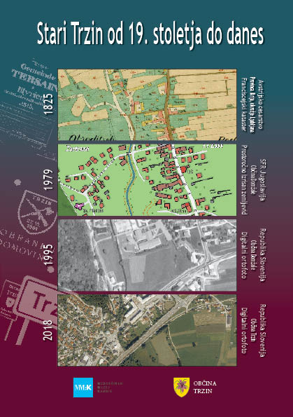
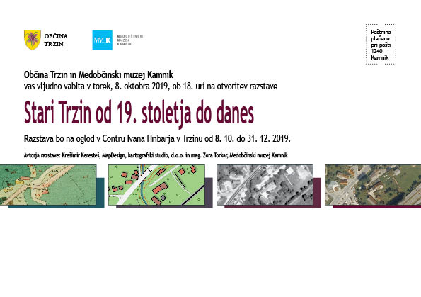
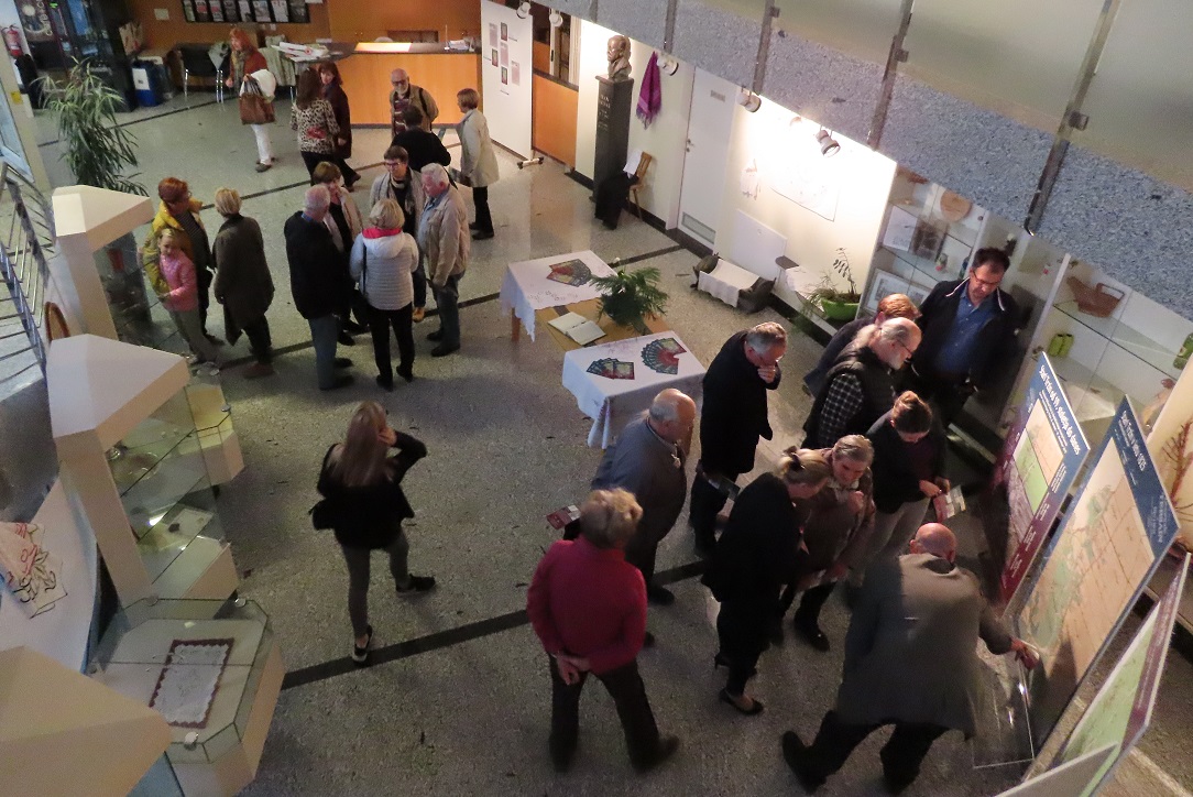
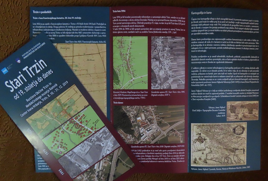
Old Trzin from the 19th century to the present
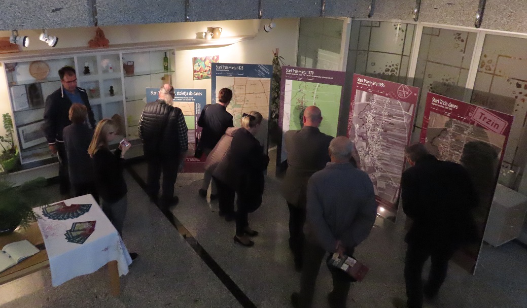
In the Center Ivan Hribar in Trzin we will open a new exhibition – Old part of Trzin from the 19th century to the present, on October 8 at 6 pm. Developments and changes in space are mapped graphically through four-time sections:
- Trzin in 1825 with an extract from the Franciscan Cadastre,
- Trzin between 1971 and 1979 on a hand-drawn map,
- Trzin in 1994 on orthophoto,
- Trzin today – in 2019 on a panoramic map.
During the Franciscan Cadastre, Trzin shows the situation in the first half of the 19th century. The Franciscan cadastre was named after the Austrian Emperor Franz I. In 1832, 590 people lived in 93 houses. They survived through agriculture and crafts.
In SFR Yugoslavia, the production of topographic products was taken over by the Military Geographical Institute in Belgrade and the Hydrographic Institute in Split. In Slovenia Geodetski zavod Slovenija has carried out systematic aerial filming since 1975; in 1985 it began to perform cyclical aerial photography, and from 1994 began the production of orthophoto plans, “mosaics” of aerial photographs. When the Geodetski zavod Slovenije (Surveying and Mapping Authority of Slovenia) ceased operations in 2010, a number of mapping and surveying companies have emerged and continue their tradition. These include MapDesign, a mapping studio, d.o.o. from Trzin, who also produced two exhibited maps of the old part of Trzin, namely the situation from the 1970s and today.
The materials for the cartographic presentation of Trzin were provided by: Archives of the Republic of Slovenia, Surveying and Mapping Authority of the Republic of Slovenia, MapDesign, cartographic studio, d.o.o., Intermunicipal Museum Kamnik.
The exhibition is accompanied by a leaflet with brief historical outlines and an overview of the development of cartography in our country. The project was funded by the Municipality of Trzin and the Ministry of Culture.